 Before this India had launched six regional navigational satellites (IRNSS-1A, 1B, 1C, ID, 1E and 1F) as part of a constellation of seven satellites to provide accurate position information service to users across the country and the region, extending up to an area of 1,500 km. Indian Space Research Organisation (ISRO) has kept two satellites ready on ground to address difficulties, if any. Before this India had launched six regional navigational satellites (IRNSS-1A, 1B, 1C, ID, 1E and 1F) as part of a constellation of seven satellites to provide accurate position information service to users across the country and the region, extending up to an area of 1,500 km. Indian Space Research Organisation (ISRO) has kept two satellites ready on ground to address difficulties, if any.
ISRO began its journey in the field of navigation with the launch of its first IRNSS-1A in July, 2013. ISRO was able to launch all seven satellites within a span of three years. The first six satellites have already been made operational, and ISROs ground stations are able to receiving signals and the process of collaboration is in progress.
Indias navigational system which for all these years was getting referred as IRNSS is now has an operational name called NAVIC (Navigation with Indian Constellation, in vernacular the meaning of this word is Sailor or Navigator). This system is expected to offer two types of services: Standard Positioning Service (SPS) available to all the users, and Restricted Service (RS), an encrypted service provided to specific (read strategic) users. The entire system would have a lifetime of 10 years and it is expected that after a decade India would have a second generation system. The cost of entire project is expected to be less than Rs 1500 crore.
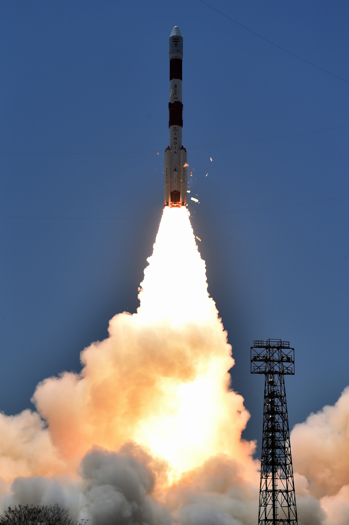
The success of recent launch speaks volumes about ISROs professionalism. The system is expected to have ground support from 15 ground stations across the country responsible for the generation and transmission of navigation parameters, satellite control, satellite ranging and monitoring, and other tasks. Presently, the Global Positioning System (GPS), a United States (US) constellation of more than 24 satellites is providing assistance to more than one billion civil users. This system mainly gets used for the purposes of rail, road, and air and sea navigation.
President Mukherjee, Prime Minister Modi Congratulate ISRO Scientists | |
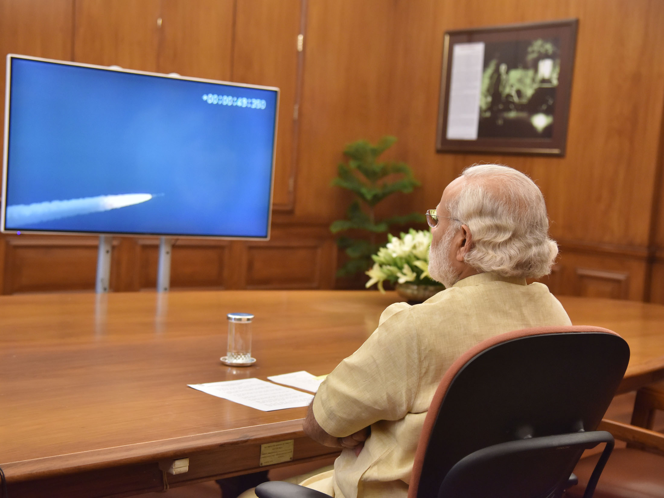
President Pranab Mukherjee and Vice President Hamid Ansari congratulated the ISRO on the successful launch of PSLV-C33 carrying IRNSS-1G, Indias seventh and final in the series of navigation satellites of the Indian Regional Navigation Satellite System (IRNSS). The launch of PSLV-C33 is an important landmark in our space programme with India now joining the small group of nations having their own regional satellite navigation system. It demonstrates, yet again, Indias growing capabilities in space launch technology. The nation is proud of this achievement.
Kindly convey my greetings to all members of your team and all others involved in this great mission. I wish the ISRO continued success in its future endeavours.
Prime Minister Narendra Modi heartily thanked and congratulated all the ISRO scientists and team ISRO for completing IRNSS constellation and dedicated IRNSS to the nation as NAVIC (Navigation Indian Constellation). He appreciated Indias space community for making the country proud through such achievements which have helped in improving the life of common man.
|
|
This system is available free of cost to all global users. For years, many nations have been using GPS, which offers real-time position, navigation, and timing (PNT) services. GPS is controlled by the US Air Force and has a global footprint; it remains the most popular global navigational system. The GPS signals are made freely available to users and its global importance is unlikely to diminish in spite of other options becoming available in near future. The US Air Force continues to upgrade this system with launching new spacecrafts as per the requirements.
India is not the only country in the world apart from the US to develop its own navigational system. Today, EU and China are developing their own satellite based navigational systems, essentially for three reasons: one, to avoid over-dependence on the US; two, freely available GPS products are appropriate only for the civilian use and have very little utility for strategic purposes; and three, satellite navigation offers various commercial prospects.
Presently, apart from the GPS, three other global satellite navigational constellations are available as options either fully or partially. The Russian system called GLONASS is one of the oldest navigational systems and it was dormant/semi active for few years, particularly after the disintegration of the erstwhile USSR. However, the system is now fully operational.
The European Union's system called Galileo was announced with a lot of hope and enthusiasm and the project officially began during 2003, but economic compulsions have delayed this project significantly. However, during last year or so the more than 10 satellites have been launched and it appears that the ESA is determined to make the system operational quickly.
China's BeiDou satellite navigation system consists of two separate satellite constellations -- a limited three satellite test system (operational since 2000). A new global navigation system known as Compass (BeiDou-2), a 35-satellite constellation, is being viewed as a system capable of challenging the supremacy of the GPS, and has both civilian and military utility.
It has been reported that its civilian service has a 10-metre location-tracking accuracy while the military service has a far better accuracy. Apart from the Peoples Liberation Army (PLA) the military service also facilitates Pakistans military establishment. Chinas fourth-generation BeiDou navigation chips are capable of locating within an accuracy of 2.5 metres, higher than the international standard. The BeiDou navigation market is estimated to be around $3-5 billion and likely to grow further.
Chinas e-commerce giant Alibaba Group Holding Ltd is set to promote the BeiDou satellite navigation system for civilian use. A capital of around $160 million has already been invested, and is expected to increase tenfold. China's proposed "Belt and Road" (B & R), a gigantic proposal linking China with Europe through Central and West Asian region via rail, road and waterways also has additional components, like the Air Silk Road and a "Space-based New Silk Road. "Naturally, their space based navigational systems has a major role to play in this regard.
Japan is also developing system which is somewhat similar to India, essentially a regional navigational system. This system is known as Quasi-Zenith Satellite System (QZSS) is under the process of development (it may be completed by 2017 or 2018) and would have four satellites while aiming at a final seven-satellite constellation in the future.
For India, NAVIC is important both for civilian usage as well as for tactical reasons. Indian armed forces are expected to benefit much from this system. ISRO claims the accuracy of the system to be less than 20 meters. This is greatly going to benefit all the three services both for the purposes of deploying platforms like tanks, aircrafts, UAVs and ships/submarines and also for accurate delivery of the weapons onto the targets.
In recent times, apart from launching of a dedicated satellite for the Indian Navy, followed by a satellite decided for strategic purposes, now ISRO is also found establishing a navigational system for the military. This indicates that now India has started using its space expertise for defence purposes too. Indian Prime Minister is also proposing that Indias neighbours should also use NAVIC for its various usages (civilian component of the signal). This shows that India is planning to use space technology as a part of its foreign policy initiative too.
Now, ISRO is proposing to undertake a launch of the indigenous version of the space shuttle. The purpose behind this proposed launch is to test the Reusable Launch Vehicle (RLV) technology. Such vehicle would be of use for the purposes of launching satellites as well as for human space mission. The proposed RLV, is a very small model (say approximately one sixth of the actual) for testing re-entry (from space to the earths atmosphere) technology. It is expected that it would take more than a decades time for India to develop a fully operational RLV. All in all, Indias space programme has emerged as programme with social, scientific and strategic purpose.
|