|
Few military applications, mostly under water
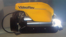
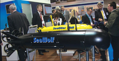
vehicles and mini submarine and Deep Submarine
Rescue Vessels models were at the show with a
plethora of soft ware applications. The Oceanology
show and the conference attracts select and interested
parties from the field of hydrographic and seismic
survey, navigation and global positioning, oil
industry interests and seekers of the potential
of the sea floor for industry and minerals, and
navies.
The exhibition, held by Reed Exhibitions and
Conferences, showcases the need for a more thorough
understanding of the oceans, deep water and satellite
processes, and their relation to the exploration
of wider marine-based opportunities and the challenges
that are being progressively overcome at sea.
A range of 200 to 500 ton seismic survey vessels
were berthed alongside the quay on the River Thames
along with advanced mine hunters from the Royal
and Dutch navies and underwater automated equipment.
Remotely operated vehicles (ROVs) autonomous under
water vehicles (AUVs), sub sea gyros and meteorology
radars and equipment were on display.
The coming advances in underwater inertial navigation,
with under seagyros, sub-sea photography to inspect
pipe lines and rigs, and remote control of installations
at sea which were on display, are predicted to
overtake the current conventional systems employed
in the offshore oil and fishing industry reducing
costs of manpower and greater reliability.
The military implications are obvious.
 The
exhibition attracted Indian agents representing
large foreign companies in India and former naval
hydrographic branch officers gainfully employed
by foreign companies were at the show. India can
surely leap-frog if it can leap into investing
for greater use of the seas. Devices for safety
at sea, latest GMDSS communications suites for
merchant ships and rigs and Automatic Identification
Systems (AIS) were on display. The
exhibition attracted Indian agents representing
large foreign companies in India and former naval
hydrographic branch officers gainfully employed
by foreign companies were at the show. India can
surely leap-frog if it can leap into investing
for greater use of the seas. Devices for safety
at sea, latest GMDSS communications suites for
merchant ships and rigs and Automatic Identification
Systems (AIS) were on display.
India’s oil industry, including ONGC, Reliance
and Cairns, seemed to have some interest.
Most companies offered live demonstrations of
their equipment with embedded software in their
fully set up systems, some of them in containers.
These also included control of ROVs and AUVs with
satellite connections and diving suits for divers
to try out on the waterfront where well clad visitors
sipped wines and beers despite the cold 6 degrees
centigrade temperatures.
A conference on global positioning and navigation,
ocean observation and forecasting, hydrography
and geophysics, marine environment and geotechnics,
free of charge by expert speakers, saw houseful
attendances. This writer’s two presentations from
India on the ISRO’s space-led advances of Gagan
air navigation and India’s own 7 satellite Indian
Regional Navigational Satellite System (IRNSS
GPS) due to be up and running by 2012, and Indian
Navy’s professional Hydrographic branch which
is producing electronic charts, evinced keen interest.
IRNSS GPS will in all probability be employed
by India’s missiles for targeting as both the
US GPS and GLONASS of Russia can be denied or
made erroneous by their controllers. Fugro Ltd
displayed the new G2 GPS which is a combination
of the US GPS and Russia’s Glonass, and the systems
are now marketed in India.
India’s expanding offshore oil industry and
the Navy’s order to build six 550 ton Catamaran
survey ships at Alcock and Ashdown Ltd at Bhavnagar,
and National Institute of Oceanology (NIO) at
Goa which has a large research ship built by Fincanteiri
of Italy have demands for modernization. India
is in the market for large purchases.
Kongsberg Vaapenfabrikk of Norway announced at
the show that its HUGGIN AUVs had been selected
for the Indian Navy’s latest survey ships. The
Indian Navy has also issued a request for information
(RFI) for a submarine rescue vessel which will
carry a DSRV as at present it is fully dependant
on the US Navy’s fly away DSRV should there be
a need for submarine rescue and India pays for
this facility.
The Oceanology Conference featured an extensive
technical programme which discussed case studies
and the latest technical developments and thinking
in the marine science and ocean technology world
in five segments. An “Oceanology Careers Day”
was organised for students or anyone interested
in pursuing a career in marine science and ocean
technology sectors. Many universities sent their
final year students to the show. There were advertisements
for the need of sales agents for the Indian market.
Some of the more interesting exhibits were in
the field of Inertial navigation and the RAMSES
by IXsea which coordinates Phins and includes
a Slaming sub sea beacon, used by submarines.
India has made enquiries for its nuclear submarine
programme. The Italian company MSS group was actively
advertising its sub sea positioning and navigation-friendly
graphical software developed for DSRVs, trenching
vessels and interfaced with ESRI’s GIS systems
called MSS NAVYSTAR 2005. Other software and digital
video acquisition suites MSS Navy CAD 2000, and
MSS Prometo were on display.
A range of multi beam sonars and multi beam echo
sounders were displayed and these are widely employed
on board the Indian Navy’s hydrographic fleet
of 8 survey ships. Lockheed Martin has recently
acquired Sippican Ltd and it displayed the Iver2
autonomous underwater expendable sound velocity
systems and sonobuoys. Most applications use Kalman
filters for correlating data which is the crux
of most under water systems, and even fishing
area predictions can be made possible with the
harnessing of space satellites and soft ware techniques.
 India
employs the OCEANSAT 2. Nautronix Ltd a leading
marine technology solutions consultant, presented
a fascinating study on sonar ray behaviour, including
spectrum bending in varied bathy temperatures
that can be gauged remotely. The solutions have
military uses in anti submarine warfare (ASW)
and obviate the older systems of collecting data
with bathy dips. India
employs the OCEANSAT 2. Nautronix Ltd a leading
marine technology solutions consultant, presented
a fascinating study on sonar ray behaviour, including
spectrum bending in varied bathy temperatures
that can be gauged remotely. The solutions have
military uses in anti submarine warfare (ASW)
and obviate the older systems of collecting data
with bathy dips.
The deep water acoustic paths are also very critical
for accurate seismic surveys and as the experts
put it: “Doing it by eye in olden days needed
luck, but not with technology now”.
CAD CAM software supported by few under water
arrays employed in a demarcated area and with
calibration by one ROV in the same area, can produce
real time and seismically accurate data of ray
bending and speed variations to predict oil, gas
and mineral possibilities.
Technology in the usage of the ocean is galloping
and competitive, and there is money to be made
from the seas, in fact, a lot of it in the business
side of exploration of the seas, and nations with
large EEZs have become attentive to it.The message
one got at Oi-2010 was, man will have to lean
on the Oceans more and more in the future for
sustenance and even habitation.
|